Many of the HYSPLIT-compatible forecast data files are available directly
from NOAA NCEP on a server called NOMADS (NOAA Operational Model Archive
and Distribution System) . NOMADS is located at:
https://nomads.ncep.noaa.gov/
We also have these data sets on our ftp server, ftp.arl.noaa.gov, in the /forecast directory. The ftp server may be accessed by a ftp client or by a web browser. 1) If you want to use a ftp client, Windows PC users may use WinSCP, FileZilla, etc. that support passive mode. MacOS and Linux users may use the ftp command. Connect your ftp client to ftp.arl.noaa.gov using anonymous and your email address for the username and password, respectively. Note if you are using multiple ftp connections, limit the number of concurrent connections equal to or less than two. Otherwise, your access to our ftp server may be blocked off. 2) If you are using a web browser, point it to
https://www.ready.noaa.gov/data/forecast.
RRFS 3 km CONUS (sigma-pressure hybrid)
The RRFS model 3 km CONUS contains sigma-pressure hybrid level forecast data
every hour from forecast hours 0 to 48 on a 3 km 1799 x 1059 grid covering the United States. There
are eight files per cycle with each one containing 6 hours of forecast data.
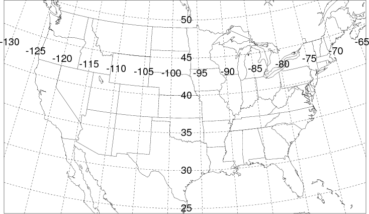
Domain map of RRFS CONUS.
- SURFACE FIELDS:
- SHGT TPP1 T02M RH2M U10M V10M PRSS LHTF SHTF USTR RGHS DSWF PBLH TCLD CAPE SOLM
- UPPER-LEVEL FIELDS: Note, these levels are sigma-pressure hybrid levels. The pressure
level is defined as:
P = A + B*PRSS,
where PRSS is the surface pressure and A.B is defined as the level
(ie., 14.824 = 838 hPa when the surface pressure is 1000 hPa)
- (.99890 .99670 .99410 .99120 .98800 .98430 .98020 .97560 .97040 .96460 .95810 .95090 1.9418 1.9327 2.9217 3.9096 5.8953 7.8798 9.8629 11.845 14.824 18.801 22.776 26.749 31.721 37.689 42.657 49.622 55.587 62.549 69.511 76.472 82.434 89.395 95.357 101.32 106.28 111.25 115.21 117.18 119.15 120.13 120.10 119.08 117.06 114.05 109.04 104.02 98.015 90.010 82.005 74.002 65.001 57.000 49.000 41.001 35.000 29.001 24.000 19.001 15.001 12.000 8.0007 5.0009 3.0003)
- PRES TEMP UWND VWND DZDT SPHU HGTS TKEN
- Filenames on FTP servers:
- hysplit.tXXz.rrsff00.conus, where XX is the cycle, contains hours 0 to 5
- hysplit.tXXz.rrsff06.conus, where XX is the cycle, contains hours 6 to 11
- hysplit.tXXz.rrsff12.conus, where XX is the cycle, contains hours 12 to 17
- hysplit.tXXz.rrsff18.conus, where XX is the cycle, contains hours 18 to 23
- hysplit.tXXz.rrsff24.conus, where XX is the cycle, contains hours 24 to 29
- hysplit.tXXz.rrsff30.conus, where XX is the cycle, contains hours 30 to 35
- hysplit.tXXz.rrsff36.conus, where XX is the cycle, contains hours 36 to 41
- hysplit.tXXz.rrsff42.conus, where XX is the cycle, contains hours 42 to 47
More Information |
NCEP RRFS Products |
NCEP Model Analysis and Forecasts
RRFS 12 km North America (pressure)
The RRFS model contain pressure level forecast data every hour from forecast
hours 0 to 84 on a 12 km 508 x 363 grid covering North America.
- SURFACE FIELDS:
- SHGT TPP1 T02M RH2M U10M V10M PRSS LHTF SHTF USTR RGHS DSWF PBLH TCLD CAPE SOLM
- UPPER-LEVEL FIELDS:
- (1000 975 950 925 900 875 850 825 800 775 750 725 700 675 650 625 600 575 550 525 500 475 450 425 400 375 350 325 300 275 250 225 200 175 150 125 100 70 50 30 20 10 7 5 2)
- TEMP UWND VWND DZDT SPHU HGTS
- Filenames on FTP servers:
hysplit.tXXz.rrfs.na, where XX is the cycle
More Information |
NCEP RRFS Products |
NCEP Model Analysis and Forecasts
RRFS 1 km Fire Weather (pressure)
The RRFS model 1 km for fire weather events contain pressure level forecast data
every hour from forecast hours 1 to 36 on a 1 km 384 x 298 grid that can vary with each model run.
Current RRFS Fire Weather Domains.
- SURFACE FIELDS:
- SHGT TPP1 T02M RH2M U10M V10M PRSS LHTF SHTF USTR RGHS DSWF PBLH TCLD CAPE SOLM
- UPPER-LEVEL FIELDS:
- (1000 975 950 925 900 875 850 825 800 775 750 725 700 675 650 625 600 575 550 525 500 475 450 425 400 375 350 325 300 275 250 225 200 175 150 125 100 70 50 30 20 10 7 5 2)
- TEMP UWND VWND DZDT SPHU HGTS
- Filenames on FTP servers:
- hysplit.tXXz.rrfs.firewx, where XX is the cycle
More Information |
NCEP RRFS Products |
NCEP Model Analysis and Forecasts
RRFS 2.5 km Hawaii (sigma-pressure hybrid)
The RRFS model Hawaii 2.5 km contain sigma-pressure hybrid level forecast data every hour from forecast
hours 0 to 48 on a 2.5 km 321 x 225 grid covering the Hawaii region.
Domain map of RRFS 2.5 km Hawaii grid.
- SURFACE FIELDS:
- SHGT TPP1 T02M RH2M U10M V10M PRSS LHTF SHTF USTR RGHS DSWF PBLH TCLD CAPE SOLM
- UPPER-LEVEL FIELDS: Note, these levels are sigma-pressure hybrid levels. The pressure
level is defined as:
P = A + B*PRSS,
where PRSS is the surface pressure and A.B is defined as the level
(ie., 14.824 = 838 hPa when the surface pressure is 1000 hPa)
- (.99890 .99670 .99410 .99120 .98800 .98430 .98020 .97560 .97040 .96460 .95810 .95090 1.9418 1.9327 2.9217 3.9096 5.8953 7.8798 9.8629 11.845 14.824 18.801 22.776 26.749 31.721 37.689 42.657 49.622 55.587 62.549 69.511 76.472 82.434 89.395 95.357 101.32 106.28 111.25 115.21 117.18 119.15 120.13 120.10 119.08 117.06 114.05 109.04 104.02 98.015 90.010 82.005 74.002 65.001 57.000 49.000 41.001 35.000 29.001 24.000 19.001 15.001 12.000 8.0007 5.0009 3.0003)
- TEMP UWND VWND WWND SPHU TKEN
- Filenames on FTP servers:
- hysplit.tXXz.rrfs.hi, where XX is the cycle
More Information |
NCEP RRFS Products |
NCEP Model Analysis and Forecasts
RRFS 3 km Alaska (pressure)
The RRFS model Alaska 3 km contain pressure hybrid level forecast data every hour from forecast
hours 0 to 48 on a 3 km 1649 x 1105 grid covering the Alaska region. There are eight files
per cycle with each one containing 6 hours of forecast data.
Domain map of RRFS 3 km Alaska grid.
- SURFACE FIELDS:
- SHGT TPP1 T02M RH2M U10M V10M PRSS LHTF SHTF USTR RGHS DSWF PBLH TCLD CAPE SOLM
- UPPER-LEVEL FIELDS:
- (1000 975 950 925 900 875 850 825 800 775 750 725 700 675 650 625 600 575 550 525 500 475 450 425 400 375 350 325 300 275 250 225 200 175 150 125 100 700 50 30 20 10 7 5 2)
- TEMP UWND VWND DZDT SPHU HGTS
- Filenames on FTP servers:
- hysplit.tXXz.rrsff00.ak, where XX is the cycle, contains hours 0 to 5
- hysplit.tXXz.rrsff06.ak, where XX is the cycle, contains hours 6 to 11
- hysplit.tXXz.rrsff12.ak, where XX is the cycle, contains hours 12 to 17
- hysplit.tXXz.rrsff18.ak, where XX is the cycle, contains hours 18 to 23
- hysplit.tXXz.rrsff24.ak, where XX is the cycle, contains hours 24 to 29
- hysplit.tXXz.rrsff30.ak, where XX is the cycle, contains hours 30 to 35
- hysplit.tXXz.rrsff36.ak, where XX is the cycle, contains hours 36 to 41
- hysplit.tXXz.rrsff42.ak, where XX is the cycle, contains hours 42 to 47
More Information |
NCEP RRFS Products |
NCEP Model Analysis and Forecasts
RRFS 2.5 km Puerto Rico (sigma-pressure hybrid)
The RRFS model Puerto Rico 2.5 km contains sigma-pressure hybrid level forecast data every
hour from forecast hours 0 to 48 on a 2.5 km 544 x 310 grid covering Puerto Rico.
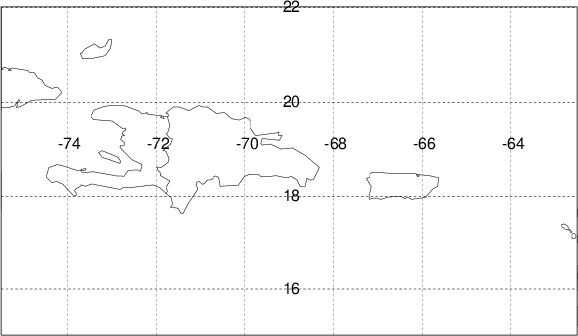
Domain map of RRFS 2.5 km.
- SURFACE FIELDS:
- SHGT TPP1 T02M RH2M U10M V10M PRSS LHTF SHTF USTR RGHS DSWF PBLH TCLD CAPE SOLM
- UPPER-LEVEL FIELDS: Note, these levels are sigma-pressure hybrid levels. The pressure
level is defined as:
P = A + B*PRSS,
where PRSS is the surface pressure and A.B is defined as the level
(ie., 14.824 = 838 hPa when the surface pressure is 1000 hPa)
- (.99890 .99670 .99410 .99120 .98800 .98430 .98020 .97560 .97040 .96460 .95810 .95090 1.9418 1.9327 2.9217 3.9096 5.8953 7.8798 9.8629 11.845 14.824 18.801 22.776 26.749 31.721 37.689 42.657 49.622 55.587 62.549 69.511 76.472 82.434 89.395 95.357 101.32 106.28 111.25 115.21 117.18 119.15 120.13 120.10 119.08 117.06 114.05 109.04 104.02 98.015 90.010 82.005 74.002 65.001 57.000 49.000 41.001 35.000 29.001 24.000 19.001 15.001 12.000 8.0007 5.0009 3.0003)
- PRES TEMP UWND VWND DZDT SPHU HGTS TKEN
- Filenames on FTP servers:
- hysplit.tXXz.rrfs.pr, where XX is the cycle
More Information |
NCEP RRFS Products |
NCEP Model Analysis and Forecasts
REFS CONUS (pressure)
The Rapid Refresh Forecast System Ensemble model contains 5 members' pressure-level forecast data every hour from forecast hours 0 to 35. All members are on a 3 km 1792 x 1059 grid.
Domain map of REFS CONUS 3 km.
- SURFACE FIELDS:
- SHGT TPP1 T02M RH2M U10M V10M PRSS LHTF SHTF USTR RGHS DSWF PBLH TCLD CAPE SOLM
- UPPER-LEVEL FIELDS:
- (1000 975 950 925 900 875 850 825 800 775 750 725 700 675 650 625 600 575 550 525 500 475 450 425 400 375 350 325 300 275 250 225 200)
- TEMP UWND VWND DZDT SPHU HGTS
- Filenames on FTP servers:
- hysplit.tXXz.refsf00.conus.mNNN where XX is the cycle (hours 0 to +5)
- hysplit.tXXz.refsf06.conus.mNNN where XX is the cycle (hours +6 to +16)
- hysplit.tXXz.refsf17.conus.mNNN where XX is the cycle (hours +17 to +28)
- hysplit.tXXz.refsf30.conus.mNNN where XX is the cycle (hours +30 to +35)
- where NNN is the ensemble member index 001, 002, 003, 004, or 005.
More Information |
NCEP REFS Products |
NCEP Model Analysis and Forecasts
REFS Alaska (pressure)
The Rapid Refresh Forecast System Ensemble model contains 5 members' pressure-level forecast data every hour from forecast hours 0 to 35. All members are on a ~3 km 1649 x 1105 grid.
Domain map of REFS Alaska 3 km.
- SURFACE FIELDS:
- SHGT TPP1 T02M RH2M U10M V10M PRSS LHTF SHTF USTR RGHS DSWF PBLH TCLD CAPE SOLM
- UPPER-LEVEL FIELDS:
- (1000 975 950 925 900 875 850 825 800 775 750 725 700 675 650 625 600 575 550 525 500 475 450 425 400 375 350 325 300 275 250 225 200 175 150 125 100 70 50 30 20 10 7 5 2)
- TEMP UWND VWND DZDT SPHU HGTS
- Filenames on FTP servers:
- hysplit.tXXz.refsf00.ak.mNNN where XX is the cycle (hours 0 to +5)
- hysplit.tXXz.refsf06.ak.mNNN where XX is the cycle (hours +6 to +16)
- hysplit.tXXz.refsf17.ak.mNNN where XX is the cycle (hours +17 to +28)
- hysplit.tXXz.refsf30.ak.mNNN where XX is the cycle (hours +30 to +35)
- where NNN is the ensemble member index 001, 002, 003, 004, or 005.
More Information |
NCEP REFS Products |
NCEP Model Analysis and Forecasts
REFS Hawaii (pressure)
The Rapid Refresh Forecast System Ensemble model contains 5 members' pressure-level forecast data every hour from forecast hours 0 to 35. All members are on a 2.5 km 321 x 225 grid.
Domain map of REFS Hawaii 2.5 km.
- SURFACE FIELDS:
- SHGT TPP1 T02M RH2M U10M V10M PRSS LHTF SHTF USTR RGHS DSWF PBLH TCLD CAPE SOLM
- UPPER-LEVEL FIELDS:
- (1000 975 950 925 900 875 850 825 800 775 750 725 700 675 650 625 600 575 550 525 500 475 450 425 400 375 350 325 300 275 250 225 200 175 150 125 100 70 50 30 20 10 7 5 2)
- TEMP UWND VWND DZDT SPHU HGTS
- Filenames on FTP servers:
- hysplit.tXXz.rrfs.hi.mNNN where XX is the cycle (hours 0 to +35)
- where NNN is the ensemble member index 001, 002, 003, 004, or 005.
More Information |
NCEP REFS Products |
NCEP Model Analysis and Forecasts
REFS Puerto Rico (pressure)
The Rapid Refresh Forecast System Ensemble model contains 5 members' pressure-level forecast data every hour from forecast hours 0 to 35. All members are on a 2.5 km 544 x 310 grid.
Domain map of REFS Puerto Rico 2.5 km.
- SURFACE FIELDS:
- SHGT TPP1 T02M RH2M U10M V10M PRSS LHTF SHTF USTR RGHS DSWF PBLH TCLD CAPE SOLM
- UPPER-LEVEL FIELDS:
- (1000 975 950 925 900 875 850 825 800 775 750 725 700 675 650 625 600 575 550 525 500 475 450 425 400 375 350 325 300 275 250 225 200 175 150 125 100 70 50 30 20 10 7 5 2)
- TEMP UWND VWND DZDT SPHU HGTS
- Filenames on FTP servers:
- hysplit.tXXz.rrfs.pr.mNNN where XX is the cycle (hours 0 to +35)
- where NNN is the ensemble member index 001, 002, 003, 004, or 005.
More Information |
NCEP REFS Products |
NCEP Model Analysis and Forecasts
HRRR 3 km (pressure)
The High Resolution Rapid Refresh (HRRR) model contains pressure level forecast data every hour from forecast
hours 0 to 18 on a 3 km 1799 x 1059 grid covering the United States
and Southern Canada. Domain map of HRRR 3 km.
- SURFACE FIELDS:
- SHGT PRSS MSLP TPP1 DIFR T02M DP2M PBLH DSWF ULWF U10M V10M
VSBY CSNO CICE CFZR CRAI LIB4 CAPE CINH TCLD REFC CLDB CLDT
LTNG PRAT LISD
- UPPER-LEVEL FIELDS:
- (1013 1000 975 950 925 900 875 850 825 800 775 750 725 700 675 650 625 600 575
550 525 500 475 450 425 400 375 350 325 300 275 250 225 200 175 150 125 100 75 50)
- TEMP UWND VWND WWND DIFW RELH HGTS
- Filename on FTP servers:
- hysplit.tXXz.hrrrpf, where XX is the cycle (00, 03, 06, 09, 12, 15, 18, 21)
More Information |
NCEP HRRR Products |
NCEP Model Analysis and Forecasts
HRRR 3 km (sigma)
The High Resolution Rapid Refresh (HRRR) model contains sigma level forecast data every hour from forecast
hours 0 to 18 on a 3 km 1799 x 1059 grid covering the United States
and Southern Canada.
At forecast hour 0, the data are a 1-hour forecast from the previous cycle.
Domain map of HRRR 3 km.
- SURFACE FIELDS:
- SHGT MSLP TPP1 DIFR T02M RH2M U10M V10M PRSS LHTF SHTF USTR RGHS DSWF PBLH
TCLD REFC CAPE
- UPPER-LEVEL FIELDS:
- (1.0 0.9990 0.9960 0.9905 0.9810 0.9670 0.9490 0.9275 0.9040 0.8785
0.8500 0.8185 0.7840 0.7465 0.7060 0.6625 0.6160 0.5670 0.5195 0.4767
0.4385 0.4041 0.3729 0.3449 0.3198 0.2767 0.2412 0.2118 0.1836 0.1553
0.1271 0.0989 0.0718 0.0527 0.0304 0.0124)
- TEMP UWND VWND WWND DIFW SPHU TKEN PRES
- Filenames on FTP servers:
- hysplit.tXXz.hrrrf, where XX is the cycle (all hours, large data set)
- hysplit.tXXz.hrrrf00, where XX is the cycle (hours 0 to +5)
- hysplit.tXXz.hrrrf06, where XX is the cycle (hours +6 to +11)
- hysplit.tXXz.hrrrf12, where XX is the cycle (hours +12 to +17)
- hysplit.tXXz.hrrrf18, where XX is the cycle (hour +18)
More Information |
NCEP HRRR Products |
NCEP Model Analysis and Forecasts
GFS Model (1 degree, pressure)
The Global Forecasting System (GFS) one-degree latitude-longitude grid contains forecast data every 3
hours from forecast hours 0 to 240 covering the globe.
The model data is updated 4 times per day.
- SURFACE FIELDS:
- PRSS MSLP TPP6 UMOF VMOF SHTF DSWF RH2M U10M V10M T02M TCLD SHGT CAPE CINH LISD LIB4 PBLH
- UPPER-LEVEL FIELDS:
- (1000 975 950 925 900 850 800 750 700 650 600 550 500 450 400 350 300 250 200 150 100)
- HGTS TEMP UWND VWND RELH WWND
- (50)
- HGTS TEMP UWND VWND RELH
- (20)
- HGTS TEMP UWND VWND
- Filenames on FTP servers:
- hysplit.tXXz.gfsf, where XX is the cycle
More Information |
NCEP Model Analysis and Forecasts
GFS (Long Range) Model
The Global Forecasting System or GFSlr (we sometimes denote this very long forecast GFS dataset with lr) contains
forecast data every 6 hours from forecast hours 240 to 384 on a 1.0 degree latitude/longitude grid
covering the globe.
- SURFACE FIELDS:
- PRSS MSLP TPP6 UMOF VMOF SHTF DSWF RH2M U10M V10M T02M TCLD
- UPPER-LEVEL FIELDS:
- (1000 975 950 925 900 850 800 750 700 650 600 550 500 450 400 350 300 250 200 150 100)
- HGTS TEMP UWND VWND RELH WWND
- (50)
- HGTS TEMP UWND VWND RELH
- (20)
- HGTS TEMP UWND VWND
- Filenames on FTP servers:
- hysplit.tXXz.gfslrf, where XX is the cycle
More Information |
NCEP Model Analysis and Forecasts
GFS (0.25 degree, sigma-pressure hybrid) Model
The Global Forecasting System (GFS) quarter-degree latitude-longitude grid contains sigma-pressure hybrid level forecast model
output every 3 hours from forecast hours 0 to 84 covering the globe (each file contains 8 time periods or 1 day).
- SURFACE FIELDS:
- PRSS MSLE UMOF VMOF TPP6 SHTF DSWF SPH2 U10M V10M T02M TCLD PBLH LHTF USTR RGHS PTRO (PTRO-pressure of tropopause) SHGT
- UPPER-LEVEL FIELDS: Note, these levels are sigma-pressure hybrid levels. The pressure
level is defined as:
P = A + .B*PRSS,
where PRSS is the surface pressure and A.B is defined as the level
(ie., 16.853 = 869 hPa when the surface pressure is 1000 hPa [P=16+0.853*1000])
- (1.0000 0.9999 0.9947 0.9886 0.9817 0.9739 1.9648 1.9544 2.9425 4.9288 6.9132 8.8954 11.8750 16.8530 21.8270 26.7990
33.7690 41.7350 49.6990 59.6600 69.6190 80.5760 91.5310 102.4900 113.4400 123.3900 133.3500 143.3000 151.2600 157.2200
162.1800 165.1500 166.1200 165.0900 162.0700 157.0500 150.0400 142.0200 132.0100 122.0100 111.0000 99.0020 88.0000 78.0000
68.0000 59.0000 52.0000 45.0000 39.0000 34.0000 29.0000 25.0000 21.0000 18.0000 15.0000 13.0000)
- TEMP UWND VWND RELH PRES
- Filenames on FTP servers:
- hysplit.tXXz.gfs0p25f, where XX is the cycle (all hours, large data set)
- hysplit.tXXz.gfs0p25000, where XX is the cycle (hours 0 to +21)
- hysplit.tXXz.gfs0p25024, where XX is the cycle (hours +24 to +45)
- hysplit.tXXz.gfs0p25048, where XX is the cycle (hours +48 to +69)
- hysplit.tXXz.gfs0p25072, where XX is the cycle (hours +72 to +84)
More Information |
NCEP Model Analysis and Forecasts
GEFS
The Global Ensemble Forecast System model contains 31 members' pressure-level forecast data every three hours from forecast hours 0 to 84 on a global half-degree latitude by longitude 720 x 361 grid.
Domain map of GEFS.
- SURFACE FIELDS:
- PRSS MSLP TPP6 UMOF VMOF SHTF DSWF RH2M U10M V10M T02M TCLD SHGT CAPE PBLH
- UPPER-LEVEL FIELDS:
- HGTS TEMP UWND VWND RELH WWND
- (RELH is not available at 20 hPa; WWND is not available at 50 and 20 hPa)
- (1000 975 950 925 900 850 800 750 700 650 600 550 500 450 400 350 300 250 200 150 100 50 20 10)
- Filenames on FTP servers:
- hysplit.tXXz.gefs.gec00, control, where XX is the cycle
- hysplit.tXXz.gefs.gepNN, where XX is the cycle and NN the perturbation number (01 - 30)
More Information |
NCEP Model Analysis and Forecasts
GEFS (Medium Range)
The Global Ensemble Forecast System model contains 31 members' pressure-level forecast data every three hours from forecast hours 87 to 240 on a global half-degree latitude by longitude 720 x 361 grid.
Domain map of GEFS.
- SURFACE FIELDS:
- PRSS MSLP TPP6 UMOF VMOF SHTF DSWF RH2M U10M V10M T02M TCLD SHGT CAPE PBLH
- UPPER-LEVEL FIELDS:
- HGTS TEMP UWND VWND RELH WWND
- (RELH is not available at 20 hPa; WWND is not available at 50 and 20 hPa)
- (1000 975 950 925 900 850 800 750 700 650 600 550 500 450 400 350 300 250 200 150 100 50 20 10)
- Filenames on FTP servers:
- hysplit.tXXz.gefsmrf.gec00, control, where XX is the cycle
- hysplit.tXXz.gefsmrf.gepNN, where XX is the cycle and NN the perturbation number (01 - 30)
More Information |
NCEP Model Analysis and Forecasts
GEFS (Long Range)
The Global Ensemble Forecast System model contains 31 members' pressure-level forecast data every six hours from forecast hours 246 to 360 on a global half-degree latitude by longitude 720 x 361 grid.
Domain map of GEFS.
- SURFACE FIELDS:
- PRSS MSLP TPP6 UMOF VMOF SHTF DSWF RH2M U10M V10M T02M TCLD SHGT CAPE PBLH
- UPPER-LEVEL FIELDS:
- HGTS TEMP UWND VWND RELH WWND
- (RELH is not available at 20 hPa; WWND is not available at 50 and 20 hPa)
- (1000 975 950 925 900 850 800 750 700 650 600 550 500 450 400 350 300 250 200 150 100 50 20 10)
- Filenames on FTP servers:
- hysplit.tXXz.gefslrf.gec00, control, where XX is the cycle
- hysplit.tXXz.gefslrf.gepNN, where XX is the cycle and NN the perturbation number (01 - 30)
More Information |
NCEP Model Analysis and Forecasts