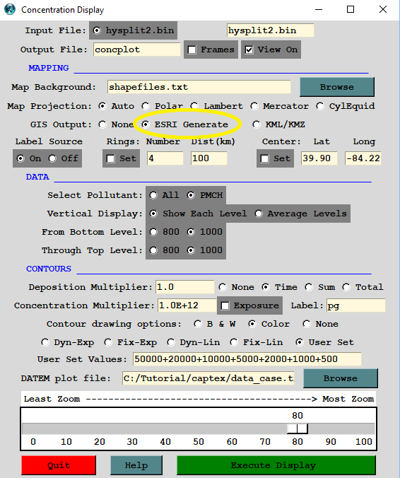
Shapefiles and ArcExplorer: |
- Most plotting programs have an option to create an output file in ESRI generate format (either -a or -g)
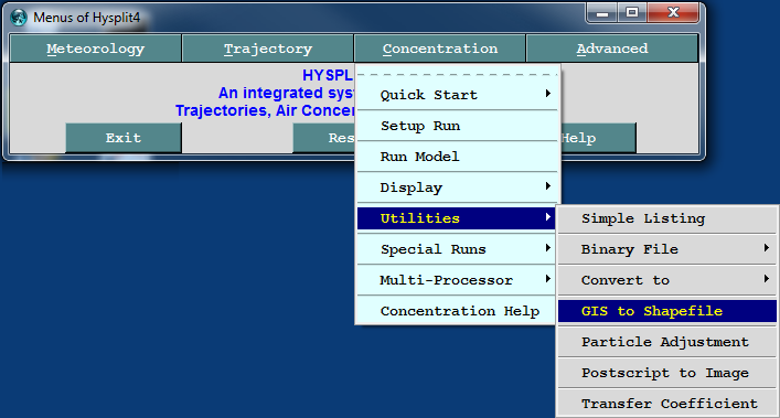
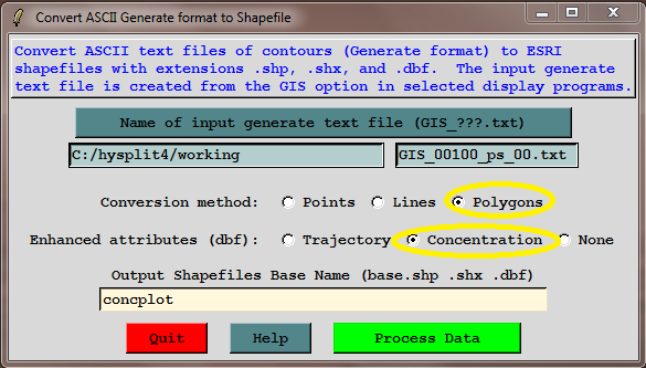
- GNU utility programs are used to convert the generate format file to a points, line, or polygon shapefile
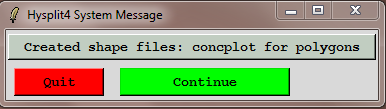
- Four output files will be created (*.shp, *.shx, *.dbf, *.prj)